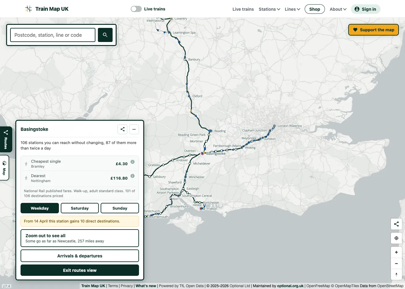
See a station's whole reach
Open a station and tap Routes. The map clears away everything else and draws only the railway your direct services actually use: every line you can ride from that station to its destination in one go. It's an honest picture of a place's connectivity: a major interchange spreads across the country, while a branch-line halt traces a single thread to the nearest junction.
It knows what day it is
Switch between Weekday, Saturday and Sunday and the railway redraws for that day. Sunday is a distinctly smaller network (around a quarter of direct connections don't run), so a station can reach far fewer places, or nothing at all, at the weekend. Days with no service are greyed out, because that's worth knowing before you travel.
Regular services and the occasional ones
A destination with four trains an hour shouldn't look the same as one with a single working a day. The map sizes each reach by how often it's actually served and draws the rarely-used rails as a faint, dashed line. It frames the view on the regular network, with a button to zoom out and take in the occasional long-distance workings, so a station isn't dragged across the map by one daily train to the other end of the country.
The live trains on those lines
Turn the picture live: the real trains running on the lines out of your station appear on top of them, moving in near real time and coloured by how late they are, without the rest of the country's traffic cluttering the view. Tap any train to follow it along its route.
Upcoming timetable changes
Timetables change a few times a year. If a station is about to gain or lose a direct destination, the Routes view says so and gives the date, handy when you're planning a trip across a timetable change and don't realise the service is about to shift.
Frequently asked questions
What counts as a direct train?
One you can stay on from your station to the destination without changing. The Routes view shows every station reachable that way and draws the lines those services run along.
Where does the data come from?
Network Rail's daily national timetable. Each day the map works out, for every station, which places have a direct service and how often, then draws the route those trains take along the real track.
Does it change by day of the week?
Yes. Weekday, Saturday and Sunday each draw their own railway, because the service genuinely differs, most sharply on Sundays.
Is it free?
Yes: free to use, no ads, no sign-up needed. Train Map UK is a passion project; donations go towards hosting and keeping the data fresh.
Part of the complete railway map
The Routes view sits on top of the complete UK railway map: every line and station, the live trains, and optional layers for the London Underground, heritage railways, disused lines and closed stations.