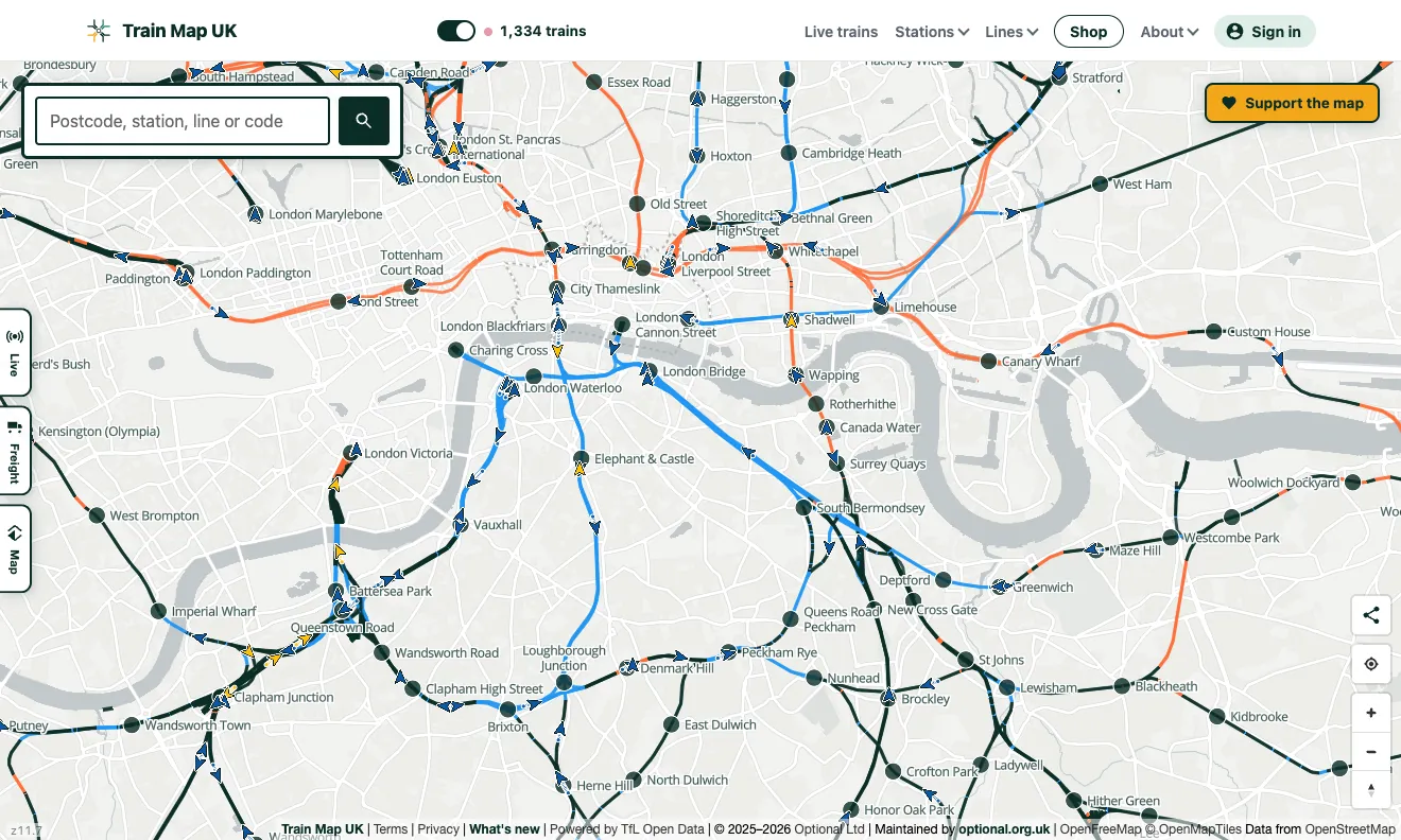
Real trains, from the official data
The layer is powered by Darwin, National Rail's real-time train information system, the same source that drives station departure boards. As trains report in along their journeys, the map places each one on the actual track between its last and next calling points and moves it forward in near real time.
Read the railway at a glance
Every train is an arrow pointing the way it's travelling, so you can see the flow of traffic on a line: expresses overtaking stoppers, trains queuing outside a busy terminus, or a late-running service (gold or red) threading between on-time ones. Tap any train to follow it: the map locks onto the moving arrow and keeps it centred, with a panel showing its route, next stop, formation and exactly how late it's running, and a one-tap zoom-in for a closer look. Positions refresh every 15 seconds, and each arrow glides along the curve of its line between updates.
A good guide, not GPS
Between stations a train's position is estimated from its reported and predicted timings, interpolated along the real track geometry. That makes it a reliable picture of where things are and how they're flowing, but it's an estimate, not GPS. Right after opening, allow a few seconds for the first trains to appear and start moving.
A train that stops reporting is the case where that estimate can go wrong, and it used to go wrong quietly: the map kept moving the train down the line at line speed, because the railway's own predictions for the stations ahead keep being pushed back for as long as it stays put. Such a train now holds its last confirmed position and says Not reporting. The note on the Lewes derailment shows exactly how far wrong it went, and what changed.
Frequently asked questions
How accurate are the train positions?
Positions come from National Rail's live Darwin running data: each train's reported and estimated times at the stations along its route, interpolated along the actual track in between. Treat the dots as a good guide rather than a GPS fix.
Is the live train map free?
Yes: free to use, no ads, no sign-up needed. Train Map UK is a passion project; donations go towards hosting and keeping the data fresh.
How often does the map update?
Every 15 seconds, with trains gliding smoothly along their routes between updates.
Part of the complete railway map
The live layer sits on top of the complete UK railway map: every line and station, plus optional layers for the London Underground, heritage railways, disused lines and closed stations.