The lost railways of East Renfrewshire poster
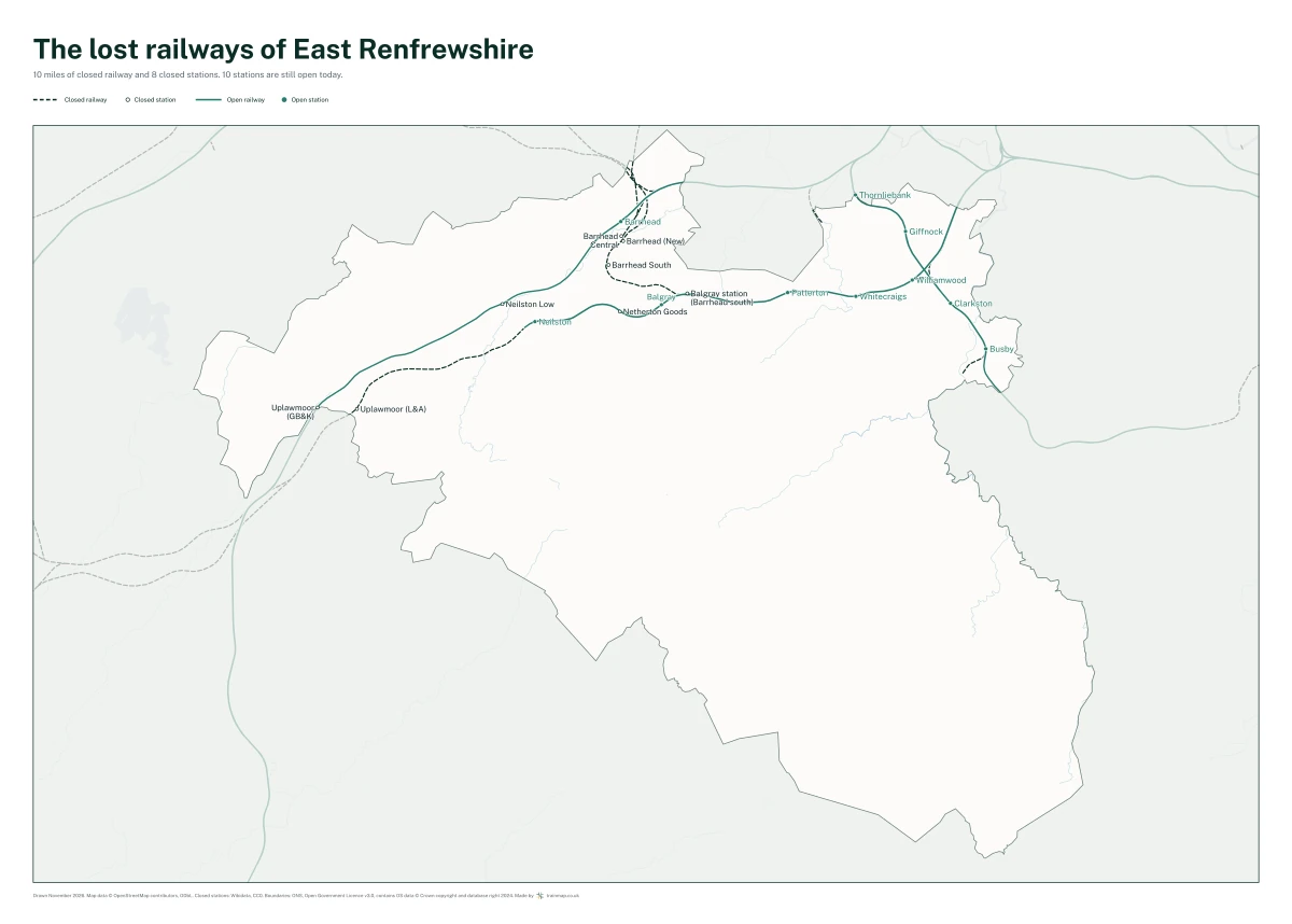
Every closed railway line and station in East Renfrewshire, drawn over the railway still running. A 50 x 70 cm print.
£27.50
£27.50 UK delivery included. No account needed.
- Size 50 x 70 cm (500 x 700 mm), landscape
- Paper 170 gsm semi-gloss silk, FSC-certified or equivalent
- Shows 10 miles of closed railway and 8 closed stations, with the 10 stations still open
- Drawn November 2026, from OpenStreetMap and Wikidata
- Supplied unframed, rolled in a tube
- Printed in the UK
What the poster shows
East Renfrewshire has 10 miles of disused railway and 8 closed stations, against 10 stations still open today. The poster draws every one of them, the lost lines dashed and every closed station named, over the railway still running in teal. The counties around East Renfrewshire are shown faded, so it reads as a place.
The longest lost lines on it are the Lanarkshire and Ayrshire Railway (2.9 miles), the Lyoncross to Paisley St James Line (2.9 miles) and the Paisley West and Barrhead Line (1.1 miles).
It was drawn in November 2026, and says so beside the credits at the foot of the sheet, so a later edition with more of the old railway mapped can be told apart.
Delivery and returns
Sent by tracked courier, usually arriving within 5 to 7 working days in the UK. Delivery is included in the price. You may cancel within 14 days of receiving your order for any reason and return it for a full refund; return postage is yours unless the item arrived damaged or faulty. If it arrives damaged, email us with a photo and we will replace it. We are not VAT registered, so no VAT is charged. The full terms for buying a print are on the terms page, and the checkout asks you to accept them.
Map data © OpenStreetMap contributors, Open Database Licence. Closed stations from Wikidata, public domain (CC0). County boundaries from the Office for National Statistics, Open Government Licence v3.0; contains OS data © Crown copyright and database right 2024.