East Croydon direct routes poster
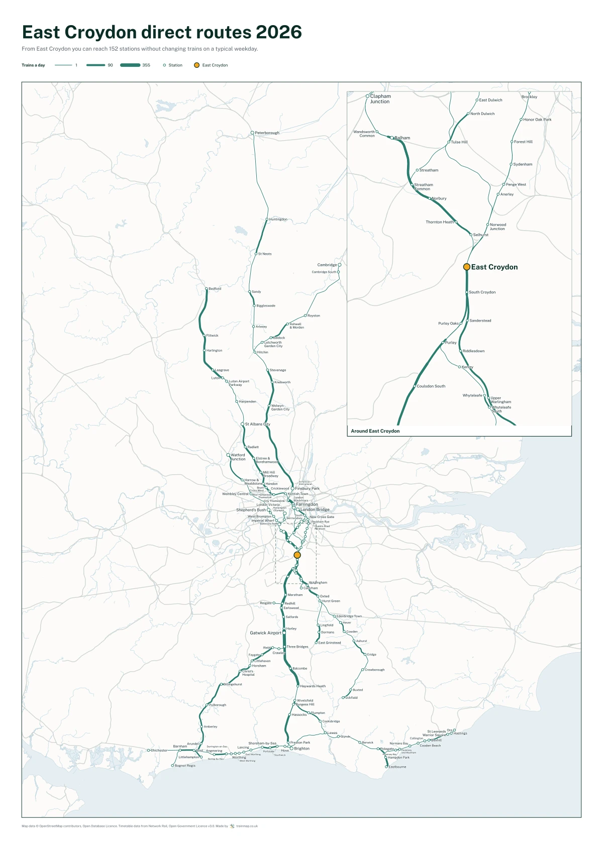
Every station you can reach from East Croydon without changing trains, drawn on the track the trains take. A 50 x 70 cm print.
£27.50
£27.50 UK delivery included. No account needed.
- Size 50 x 70 cm (500 x 700 mm)
- Paper 170 gsm semi-gloss silk, FSC-certified or equivalent
- Shows From East Croydon you can reach 152 stations without changing trains on a typical weekday, and 166 including weekends
- Supplied unframed, rolled in a tube
- Printed in the UK
What the poster shows
From East Croydon you can reach 152 stations without changing trains on a typical weekday, and 166 including weekends. The poster draws every one of those routes on the track the trains actually run on, thicker where more trains run, and names every station. It is framed to East Croydon's own routes, with the busiest part enlarged in a panel of its own.
The busiest places it reaches include London Bridge, London Victoria, Farringdon, Clapham Junction, Gatwick Airport and Brighton.
The weekday version shows a typical weekday; the other adds the trains that only run at weekends. Each is drawn from Network Rail's timetable over several weeks, so a day of engineering work cannot take a route off the map.
Delivery and returns
Sent by tracked courier, usually arriving within 5 to 7 working days in the UK. Delivery is included in the price. You may cancel within 14 days of receiving your order for any reason and return it for a full refund; return postage is yours unless the item arrived damaged or faulty. If it arrives damaged, email us with a photo and we will replace it. We are not VAT registered, so no VAT is charged. The full terms for buying a print are on the terms page, and the checkout asks you to accept them.
Map data © OpenStreetMap contributors, Open Database Licence. Timetable data from Network Rail, Open Government Licence v3.0.